

Remote Sensing Applications in Civil Engineering
Remote sensing may be defined as art and science of gathering the information about objects, occurrence or area without having physical contact with it. Eyesight’s and photographs are common examples of remote sensing in which artificial light energy from electricity or sunlight is made to strike an object.
Light energy consists of electromagnetic waves of all length and intensity. When electromagnetic wave falls on the object, it is partly
-
Absorbed
-
Scattered
-
Transmitted
-
Reflected
Diverse objects have different properties of absorbing, scattering, transmitting and reflecting the energy. By capturing reflected waves with sensors, it is possible to identify the objects. However this remote sensing has its own limitations in terms of distance and coverage of area at a time.
As per the photographic survey, in which the photographs are taken from aircrafts and are used for map making, fall under this category of remote sensing. By using electronic equipments, the basic remote sensing technique will be extended to identify and quantify various objects on the earth by observing them from longer distances from the space. For this purpose, geostationary satellites are launched in the space, as they rotate around the earth at the same speed as earth. Hence, when the relative velocity is zero they tend to appear stationary when observed from any point on the earth. Depending upon the property of the object, the electromagnetic waves sent from the satellite reflected energy is different. The reflected waves in the bandwidth of infrared, thermal infrared and micro waves are picked up by sensors mounted on satellite.
Since each feature on the earth has different reflection property, it is possible to identify these features on the earth with satellite pictures. Data obtained from different satellites will be transferred to ground stations through RADARS where user analyses to find out the type of object and the extent of it. This is called image processing. For quantifying the objects computers are used. India is having its own remote sensing satellites like IRS-series, INSAT series and PSLV series.
Application of Remote Sensing
There are various applications of remote sensing which may be grouped into the following:
- Resource Exploration
- Environmental Study
- Land use
- Site Investigation
- Archaeological Investigation and
- Natural Hazards Study
Resource Exploration: Geologists use remote sensing to study the formation of sedimentary rocks and identify deposits of various minerals, detect oil fields and identify underground storage of water. Remote sensing is used for identifying potential fishing zone, coral reef mapping and to find other wealth from ocean.
Environmental Study: Remote sensing is used to study cloud motion and predict rains. With satellite data it is possible to study water discharge from various industries to find out dispersion and harmful effects, if any, on living animals. Oil spillage and oil slicks can be studied using remote sensing.
Land Use: By remote sensing, mapping of larger areas is possible in short time. Forest area, agricultural area, residential and industrial area can be measured regularly and monitored. It is possible to find out areas of different crops.
Site Investigation: Remote sensing is used extensively in site investigations for dams, bridges, pipelines. It can be used to locate construction materials like sand and gravel for the new projects.
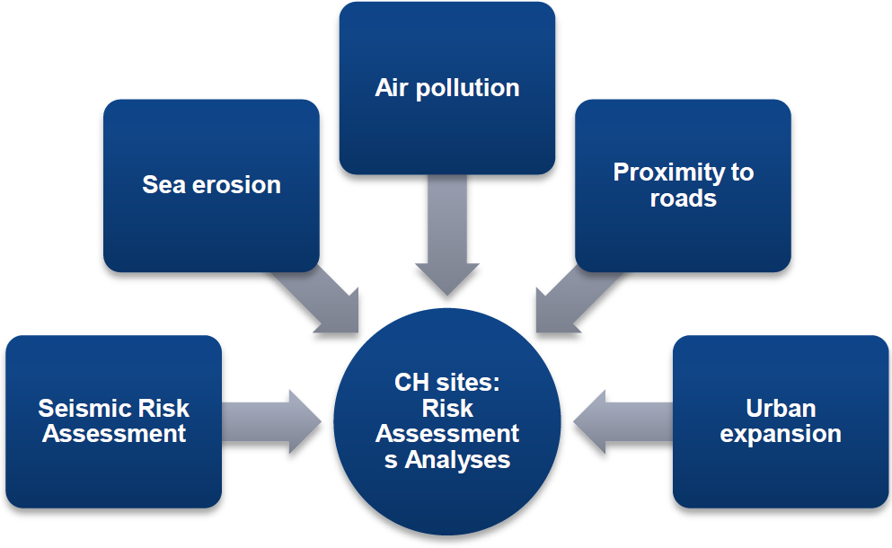
Archaeological Investigation: Many structures of old era are now buried under the ground and are not known. But by studying changes in moisture content and other characteristics of the buried objects and upper new layer, remote sensors are able to recognize the buried structures of archaeological importance.
Natural Hazard Study: Using remote sensing the following natural hazards can be predicted to some extent and hazards minimized:
- Earthquake
- Volcanoes
- Landslides
- Floods and
- Hurricane and Cyclones